
How to get there
Bosco Derniga is reached on foot, along one of the trails. You can also go up by mountain bike or with a trekking stroller along the Sentiero dei Portini. Access by motor vehicle is allowed only by displaying a resident permit or a disabled badge on your car.
The map below shows the four trails that lead up to the wood, with starting points and car parks.
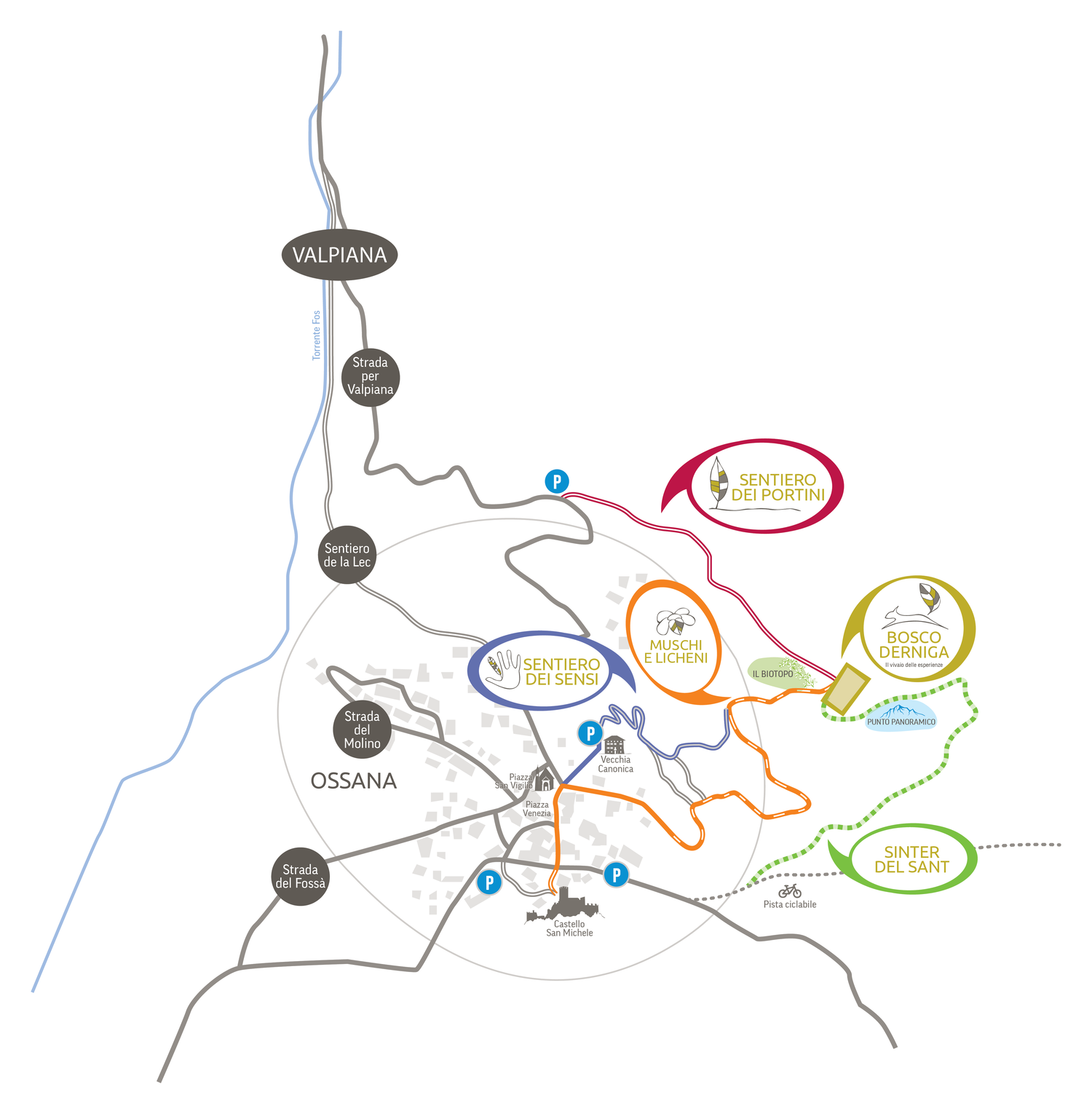
Download the high-resolution map (PDF)
The trails
Sentiero dei Portini
A historic path where, in wartime, charcoal was carried down to the valley. The trail starts from the Valpiana road, is marked with signs and is served by a small car park. Flat route, also passable by bike (MTB) and with a stroller. Average walking time: 10 minutes.
Sentiero dei Sensi
A signposted trail starting from Piazza San Vigilio, served by a small car park near the Old Rectory. The path crosses the Garden of the Senses, continues through a dense spruce forest and joins the forest road. On foot only. Average walking time: 20 minutes.
Sentiero dei Muschi e Licheni
A route starting from Piazza San Vigilio that runs along a forest road. Also accessible by bike (MTB) and with a stroller. Average walking time: 30 minutes.
Sinter del Sant
The most challenging trail: it starts from the cycle path near the car park of Ossana Castle. After a short stretch on the cycle path, turn left following the signs into the wood. The trail is steep and not suitable for strollers or bikes. Average walking time: 50 minutes.
Some sections may be temporarily closed for forestry work: we recommend checking the signs on site.